A big property deal in Boston recently hit a wall. A planned housing project in Charlestown ran into trouble because of access rights tied to Boston Sand & Gravel. The issue looks simple at first: who can use a road, and how that affects a new development. Problems like this don’t begin during construction. They start long before a buyer signs anything. Many buyers walk a site, see a driveway or road, and assume everything is fine. Then later, they find out the access is shared, limited, or controlled by someone else. That’s where an ALTA land survey for access rights helps clear things up early, showing what is actually allowed on paper and what exists on the ground.
Why access problems show up in Boston
Boston is tight. Lots are close together. Buildings sit near property lines. Roads and alleys often serve more than one property.
At the same time, many parcels come from old records. Some deeds go back decades. Some refer to landmarks that no longer exist. Others describe access in ways that feel unclear today.
Because of this, two things can be true at once. A property looks easy to enter, but legal access is limited. A path may have been used for years, yet no clear right exists in writing.
That gap causes trouble.
What an ALTA land survey actually checks
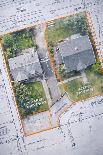
A basic survey shows where the property lines sit, which helps, but it often misses details that can affect how the property is used.
An ALTA land survey goes a step further by connecting the title records with what is actually on the ground. It also provides more clarity regarding easements and access, which are easy to overlook at first.
For example, an ALTA land survey for easements can show where entry is allowed, shared, or limited, along with paths crossing the site or driveways shared by multiple properties. Instead of relying on guesswork, it clearly lays out all these details.
This level of precision matters in a place like Boston, where even a narrow path or small access point can impact an entire project.
When physical access does not match legal access
This is where buyers get surprised.
A property may have a clear driveway. Trucks use it. Cars use it. It feels open.
After closing, the buyer learns that the driveway sits on a neighbor’s land. Or it is part of a shared easement with strict rules. Or it only allows limited use.
Now the buyer faces a problem.
Plans change. Permits slow down. Neighbors raise concerns. In some cases, the property cannot be used as planned at all.
These problems do not come from bad luck. They come from missing information before the deal closed.
Why timing matters more than anything
Access issues are easier to deal with before closing.
A buyer who knows the limits early can ask questions. They can request changes. They can adjust plans or walk away.
After closing, the options shrink.
Legal steps cost money. Fixes take time. In some cases, nothing can be changed.
That is why an alta land survey works best as part of due diligence, not after the fact.
Common Boston situations where access needs a closer look
Some properties carry more risk than others.
In Boston, pay close attention when you see:
- Rear access through an alley
- Entry that passes near another building
- Shared driveways between parcels
- Sites next to active businesses or industrial yards
- Older lots with unclear layouts
Each of these can involve rights that are not obvious during a quick visit.
Assumptions that cause real problems
Buyers often rely on what they see. That leads to mistakes.
A driveway does not always mean full access. Long-time use does not always mean legal permission. A title document does not always show how access works on the ground.
Each of these gaps can affect value and use.
An alta land survey helps close that gap.
How buyers use an ALTA land survey during a deal
The process is not complicated.
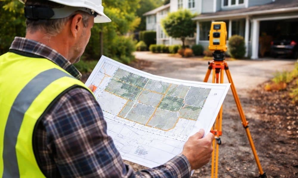
The buyer orders the survey during the review period. The surveyor studies the title record and the site. Then they produce a map that shows how everything connects.
Attorneys and lenders review it. They look for conflicts or limits tied to access.
If something looks off, the buyer can act before the deal moves forward.
That is the real value. It gives clarity at the right time.
What this means for Boston buyers
Boston deals move fast. That pressure can push buyers to skip steps or rush decisions.
Access rights do not care about speed.
A property can look perfect and still carry hidden limits. Those limits often tie back to how people enter and use the site.
The recent Charlestown dispute shows how big these issues can become. A single access conflict can affect an entire project.
Buyers who take time to confirm access stand in a stronger position. They know what they are buying. They know how they can use it.
A simple step that avoids big problems
An alta land survey is not just a form to check off. It gives a clear picture of access, rights, and limits tied to the property.
That picture helps buyers make better decisions before they commit.
If you plan to buy or develop property, check access early. Make sure what you see matches what is allowed.
That one step can save time, money, and a lot of stress later.