Buying property in Massachusetts is a big step, whether you’re purchasing a home in the city or land in the countryside. Before completing the purchase, it’s important to work with a land surveyor in Massachusetts you can trust. A professional survey ensures you understand the exact size, shape, and legal boundaries of the property—so you know exactly what you’re buying and can avoid future problems.
What Is a Land Surveyor?
A land surveyor is a trained professional who measures land. They find the exact borders of a property and create detailed maps. These maps show things like property lines, buildings, slopes, and more.
Types of surveys include:
- Boundary survey – shows the edges of the land
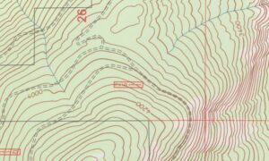
- Topographic survey – shows hills, slopes, and land shape
- Plot plan – used when applying for a building permit
- ALTA/NSPS survey – used in commercial real estate
Surveyors use tools like GPS, old land records, and special equipment to do their job.
Problems That Can Happen Without a Survey
Skipping a land survey may lead to serious problems.
1. Property Line Disputes
Without a survey, you might not know where your land ends and your neighbor’s begins. This can cause arguments, especially if a fence or driveway crosses the line.
2. Easements and Shared Access
Some parts of your land might be used by others. For example, utility companies may need to cross your property to access power lines. These are called easements, and a survey will show them.
3. Lender and Title Issues
If you’re getting a mortgage, your bank may want a survey to make sure everything is clear. A survey can also help with title insurance.
4. Resale Problems
If you ever want to sell the property, buyers will want clear boundaries. Not having a recent survey can delay the sale.
What Makes Massachusetts Unique?
Massachusetts has its own set of land issues.
- Older Land Records: Many towns in the state have very old maps and unclear records, especially in historic areas.
- Zoning and Wetlands Rules: There are many local rules about how land can be used. Some land near wetlands can’t be built on.
- Different Needs in Cities and Rural Areas: In cities, small lots need careful measurement. In rural areas, land might be large and harder to mark clearly.
A survey helps people understand these issues before making a purchase.
When to Get a Survey
It’s a good idea to get a survey before completing a property purchase. This helps avoid confusion or legal trouble later on.
Surveys are also helpful if:
- You’re buying land with no buildings
- You want to build something new
- You don’t know the exact borders of your yard or lot
- You want to divide the land into smaller parts
Choosing a Surveyor in Massachusetts
Massachusetts requires surveyors to have a professional license. Before hiring someone, check that they are licensed by the Massachusetts Board of Registration of Professional Engineers and Land Surveyors. It’s always best to work with licensed survey professionals in Massachusetts who understand the local zoning laws, land use regulations, and surveying challenges unique to the area.
Other things to look for:
- Experience in the town or area
- Use of modern equipment
- Clear pricing
- Good reviews or references
FAQ
Q: How much does a land survey cost in Massachusetts?
A: It usually costs between $500 and $2,000, depending on the size and shape of the land.
Q: Is a land survey required by law to buy a home in Massachusetts?
A: Not always, but it is often required by mortgage lenders or local building departments.
Q: How long does a survey take?
A: Most surveys take 1 to 3 weeks, depending on the size and how busy the surveyor is.


