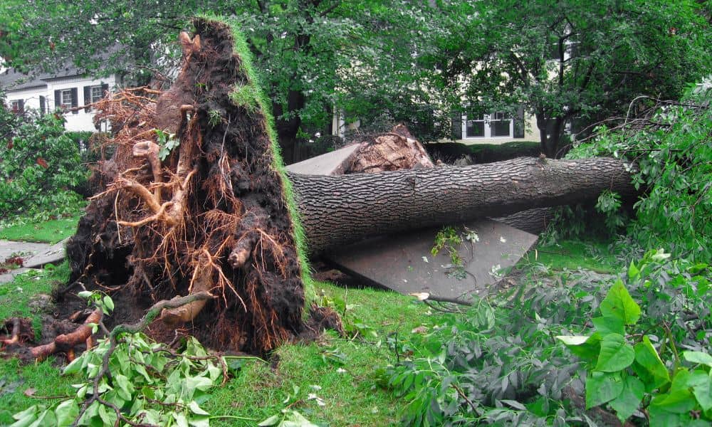
Massachusetts weather can surprise even longtime residents. Just this past week, the National Weather Service confirmed five tornadoes in MetroWest towns like Paxton, Holden, Berlin, and Stow. For many homeowners, the damage went far beyond downed trees and missing shingles. Uprooted roots tore through fences, stone walls shifted, and survey markers disappeared under debris. When storms leave behind that kind of mess, a property survey becomes more than a formality — it’s often the only way to restore clarity and prevent costly disputes.
Storms Don’t Just Knock Down Trees
When high winds sweep through, they do more than scatter branches across your lawn. They can also change how your property looks and feels. A wall that once seemed straight may lean into your neighbor’s yard. A fence could topple, leaving you unsure where to rebuild. Even driveways and walkways can lift at the edges, making boundaries look different than they actually are.
The important thing to understand is this: storms can create illusions. Your lot lines haven’t shifted, but the evidence you rely on — fences, markers, and landscaping — may have moved or vanished. That’s when disputes often arise, especially in neighborhoods where homes sit close together.
Five Red Flags After a Major Storm
As you walk your yard after a big storm, you might notice a few warning signs that your boundaries need to be re-checked. These issues tend to pop up again and again:
- Corner pins missing or buried under debris
- Stone walls out of alignment
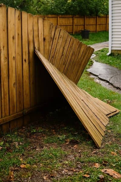
- Fences knocked down or pushed into a neighbor’s lot
- Driveway edges cracked or shifted
- New posts or markers suddenly appearing after cleanup
Each of these hints that what you see on the ground may not match the true legal boundary. Without a professional survey, you risk rebuilding in the wrong spot — and inviting conflict.
How a Property Survey Protects You
A property survey provides certainty when storms create confusion. Licensed surveyors don’t rely on fences or trees. Instead, they check your deed, compare subdivision plans, and use precise instruments to locate exact boundaries. Once that’s done, they reset or flag your corners so you know exactly where your property begins and ends.
That kind of clarity has real value. If your neighbor claims you’re encroaching, the survey gives you legal proof. If you file an insurance claim, the survey helps show what was damaged and where. And if you’re planning to sell, buyers will feel more secure knowing your lot lines are clear and documented.
What Happens During a Post-Storm Survey
Many homeowners imagine a surveyor simply walking around with a measuring tape. In reality, it’s a much more detailed process. After a storm, a surveyor will:
- Review the official records connected to your property
- Use GPS and advanced instruments to retrace your lot lines
- Mark the corners again, often with iron pins or flags
- Produce a stamped drawing you can keep for your records
In some cases, surveyors even use drones to scan damaged areas, giving a bird’s-eye view of large lots where debris hides the ground. The end result is a document that insurers, contractors, and even courts will respect.
Why Insurance and Contractors Rely on Surveys
Storm repairs often happen quickly. Roofers, fence installers, and landscapers move fast to meet demand. But when work involves property edges, rushing without a survey can lead to mistakes. Imagine paying thousands for a new fence only to learn later it sits on your neighbor’s side. That’s a dispute no homeowner wants.
Insurance companies face similar challenges. Adjusters need proof when evaluating claims. If a shed straddled the property line before it collapsed, who is responsible? A certified survey eliminates the guesswork, ensuring your claim is backed by hard data instead of assumptions.
Protecting Your Home’s Future Value
Beyond immediate cleanup, think about the long-term impact. Buyers are cautious, especially after seeing news of tornadoes in nearby towns. They want certainty. If your listing includes a recent property survey, it shows you’ve taken steps to protect your investment. It also prevents last-minute surprises at closing that could delay or even kill a deal.
A survey doesn’t just protect you now. It safeguards your home’s resale value for years to come.
When to Call a Surveyor
You don’t need to order a survey after every rainstorm. But when severe weather uproots trees, shifts structures, or leaves you unsure about your lot lines, it’s smart to bring in a professional. The peace of mind outweighs the cost.
Think of it this way: storms are temporary, but disputes can drag on for months or years. A property survey resolves questions early, saving you stress, money, and damaged relationships with neighbors.
Final Thoughts
Storms remind us that nature doesn’t respect property lines. Tornadoes and high winds can change what we see on the ground, even if the legal boundaries remain the same. That’s why a property survey is so valuable. It cuts through the confusion, provides evidence you can rely on, and helps protect both your home and your wallet.
When storms blur the lines, property surveys bring clarity. Taking that step now means fewer worries about disputes, repairs, or future sales.
