How Important is Land Surveying in Today’s World?

land surveying
Copyright c 123RF Stock Photos

Most of you have probably never thought about land surveying until you needed it at some point. Many of us hear about land surveying all the time but never really give it much thought. Since an investment in land and/or a home will likely be the largest investment you will ever make in your lifetime, knowing where your property lines are becomes very important indeed.

The art of land surveying was developed centuries ago. In fact, it’s one of the oldest professions in the world. The fact that it was used by man at such an early time and is still being used now shows how important surveying is to our survival.

The different uses of Land Surveying

Surveying land has many uses. Boundary surveying, for instance, allows you to know where your property corners or property lines are. This is especially helpful when disputes with a neighbor or with other people arise in terms of where your property ends.

If your family wants to divide a tract of land and transfer ownership to other family members, a boundary survey is the first step to do so. If you’re having a building constructed, it is very important that you have the land surveyed to make sure that you are not encroaching onto other peoples’ property. A mistaken building location is very expensive to fix so you might as well invest in a boundary survey to prevent this.

A topographic survey, or topo survey for short, is another important type of land surveying. A topo survey is done to locate natural and man-made features on a particular parcel of land. A topographic survey is different in that the elevation of the land is surveyed which means it can show man-made underground features, retaining walls, utility lines and etc.

Before you start any kind of construction activity, it’s important to have a topo survey done in the area so they’ll have an accurate record of the land’s existing conditions. Yes, that spot with the new mall in the neighborhood had to have a topo survey done first.

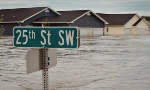
Now, a flood survey or flood determination – this is very important too. It isn’t evident just looking at a property whether you are at risk of flooding or not. And, in some cases, even looking at the flood maps doesn’t give you an accurate answer. The flood survey determines the elevation of the home and compares that to the base flood elevation.

This is the only way to be sure you’re not in a flood hazard zone. If you’ve just been told that you live in a flood-prone area, having that confirmed by a professional land surveyor would let you know how to best proceed.
When getting flood insurance, insurance companies would require an elevation certificate from you. A land surveyor would be able to assist you with this.

If a company wants to invest in another state, or if there is a national lender on a commercial project, they will likely need an ALTA Land Title Survey done before anything is constructed. An ALTA Land Title Survey is a lot like a regular boundary survey except that nationally accepted ALTA Standards are used to guide the surveying effort.

Land surveying standards vary widely from state to state and an ALTA Land Title Survey is used to cut down on this variation. Also, an ALTA Land Title Survey typically is more involved than the state standards variety. Because of this, an ALTA survey can be more anywhere from 50% to 200% more expensive than using the state standards only. If you need this type of survey, I suggest seeking an experienced land surveying company who is familiar with these additional requirements.
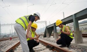
In summary, there are many uses for a land survey and for seeking the services of a land surveyor. If you’re unsure of your situation, consult ALTA Survey Massachusetts

author avatar
Surveyor

More Posts

Storm-damaged suburban house with fallen tree and downed power lines, showing why an ALTA title survey is important before insurance claims
alta survey
Surveyor

Storm Damage? Get an ALTA Title Survey Before You Claim

When a Nor’easter slams into Boston, the first thing people notice is the mess—fallen trees, flooded yards, and fences leaning where they shouldn’t. But after the cleanup, another issue starts to appear: property lines that suddenly don’t look right. That’s where an ALTA title survey becomes essential. This detailed survey

Read More »
Total station surveying instrument on a tripod at a construction site for a construction staking survey.
construction
Surveyor

When Stakes Go Missing: Construction Staking Survey Tips

If you’ve ever worked on a construction site, you know how one small mistake can spiral into chaos. A missing layout stake might seem harmless, but it can delay inspections, misalign a foundation, or even trigger legal issues. That’s why a construction staking survey is more than just a formality—it’s

Read More »
Surveyor conducting an elevation survey near a coastal property after storm waves
flood damage
Surveyor

Protect Your Property With an Elevation Survey Post-Storm

Boston’s coastline is no stranger to storms. Just last week, Hurricane Humberto stayed offshore, but its swell still hit Massachusetts with force. The National Weather Service issued warnings of high surf, rip currents, and dangerous conditions in Mass Bay and Cape Cod Bay. For many, it looked like just another

Read More »
Uprooted tree from storm damage lying across a yard, showing why a property survey is important to confirm boundaries after severe weather
boundary surveying
Surveyor

Property Survey After Storms: Protect Against Disputes

Massachusetts weather can surprise even longtime residents. Just this past week, the National Weather Service confirmed five tornadoes in MetroWest towns like Paxton, Holden, Berlin, and Stow. For many homeowners, the damage went far beyond downed trees and missing shingles. Uprooted roots tore through fences, stone walls shifted, and survey

Read More »
Drone aerial view of historic Boston rowhouses showing narrow streets and rooftops, ideal for drone land surveying applications
land surveying
Surveyor

Drone Land Surveying vs. iPhone 17 Pro Scans

Boston’s rowhouses are full of charm, but they also bring big headaches when it comes to measurements and planning. Narrow alleys, basement corners, and shared walls make every inch matter. That’s why drone land surveying has become such a useful tool for engineers, architects, and homeowners here. But with the

Read More »
Flooded residential homes with high water levels, highlighting the importance of a Flood Elevation Survey after severe storms and flooding.
flood damage
Surveyor

Flood Elevation Survey Demand Rises After Major Storms

Boston has always been a city shaped by water. From the Charles River to Boston Harbor, the landscape blends old neighborhoods with low-lying land. After the severe storms that swept through Massachusetts in early September—including a tornado in central Massachusetts and heavy rainfall across the city—many homeowners and lenders are

Read More »