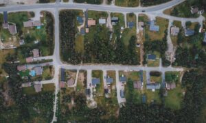
A developer finds three lots sitting side by side. On paper they belong to different owners and carry different legal descriptions. On the ground they look like one continuous piece of land. Before treating them as a single project site, the team needs a clear read on what each parcel holds and how the pieces fit together, and that is where an alta title survey earns its place.
When Several Parcels Start Looking Like One Development Site
A multi-parcel assemblage is a set of separate parcels a buyer plans to develop as one site. Each parcel still has its own owner of record, its own deed and its own legal description until something formal changes that. Buying them for a shared project is not the same as merging them into one legal lot. That second step is a legal action handled through local and state processes, not something a survey does on its own.
Developers look at adjoining lots together for a simple reason. A larger combined footprint can support a building or layout that no single lot could hold. Corner sites, mid-block gaps and back lots each add usable area or better access. So the team studies them as one opportunity long before any parcel changes hands.
Boston sees a lot of this. Redevelopment projects across the city are often built on land drawn from more than one lot. The documented project at 201-207 Brighton Avenue covers a run of addresses along one stretch of the street, the kind of site that pulls more than one lot into a single plan. Not every redevelopment works this way, but multi-parcel sites come up often enough that the assemblage question is worth handling early.
How an ALTA Title Survey Brings Separate Parcel Information Together
An ALTA/NSPS Land Title Survey shows the surveyed land against the title evidence the surveyor receives or obtains. For an assemblage, that means the parcels can be presented on one consistent drawing tied to the same field measurements and the same title record review. The team reads one coordinated picture instead of stacking unrelated documents for each lot.
The survey scope has to name the parcels or property interests under review. This sounds basic, but it matters. If the scope leaves out a strip, an access parcel or a shared interest, the drawing will show a picture the project can’t fully trust. Naming the parcels up front keeps the survey matched to the real acquisition area.
An ALTA/NSPS survey is a defined professional product. It is not a printout of tax maps or a copy of assessor data. Current ALTA/NSPS standards call for field work, a prepared plat or map, any requested Table A items and a surveyor’s certification. Table A items are optional add-ons the client selects, such as showing certain improvements or utilities. That structure is what lets a lender, an attorney and an engineer rely on the same drawing.
The survey supports evaluation of the assemblage. It does not combine the parcels into one legal lot. Merging, consolidating or subdividing land runs through local and state processes that sit outside the survey itself.
The Gaps Between Parcels Deserve Their Own Review
When parcels are studied together, the seams between them need direct attention. Each description was likely written at a different time by a different hand. Placed side by side, they may not meet as cleanly as a tax map suggests.
A few things tend to surface once the parcels share one drawing. Descriptions can read differently from one parcel to the next, even where the lots touch. Small gaps or overlaps can appear between them, the kind that only matter once the land is treated as one site. Improvements like driveways, walls or utility lines may cross from one parcel onto another. Physical use on the ground may not follow the parcel lines shown on record. The real question underneath all of it is whether the pieces, read together, form one consistent project area.
Current ALTA/NSPS standards address evidence of possession or occupation along the perimeter and set out how field work relates to the title evidence. For an assemblage, that perimeter review carries extra weight. A fence, a paved area or a long-standing use crossing the seam between two lots can shape how the combined site works. Catching it on the survey beats finding it once construction starts.
Why the Assemblage Footprint Matters Before Design Moves Forward
The design team needs a reliable read on the total land area before drawings move ahead. Square footage, shape, frontage and the location of existing features all feed early decisions. Guessing at the combined size, or trusting mismatched records, can send a concept in the wrong direction.
A shared survey gives the whole team one property reference. Architects size the building against real dimensions. Engineers plan grading and utilities against measured ground. Attorneys check the described interests, and lenders and their title company review the same base.
The survey does not decide zoning. It does not set how much can be built, and it does not promise the project will win approval. What it provides is measured property information. That information gets used next to zoning review, title work, planning input and engineering. In a city like Boston, where corridors and multi-parcel sites are active parts of the redevelopment picture, that shared reference keeps a mixed team of specialists working from the same property information while approvals and design move ahead.
What a Developer Should Confirm Before Ordering the Survey
Before ordering, settle the questions that shape a multi-parcel survey. Getting these clear up front keeps the survey matched to the project and avoids a redraw later.
Work through the points below with the survey team:
- Which parcels sit inside the acquisition or redevelopment area, and which stay out
- Whether current title commitments or other title evidence are on hand for each parcel
- Who is requesting the survey and who is paying for it
- Which survey standard the project calls for
- Which Table A items fit the project, since these are chosen and not automatic
- Whether the lender or title insurer has requirements of its own
- Whether any off-site or adjoining interest, like a shared access strip, belongs in the scope
- How the survey will line up with the legal and design teams’ work
Current ALTA/NSPS standards say the request should name it as a 2026 ALTA/NSPS Land Title Survey and spell out the Table A items wanted. Anything unusual about the property interests or the scope should be talked through and agreed on before field work starts. On an assemblage, that early conversation is where the parcel list, the title evidence and the survey scope get locked together.