A new utility extension can look simple on paper. The engineer draws a line from an existing main to a new site, the contractor prices the trench and everyone expects the pipe to land where the plans show it. Trouble starts when nobody plans the survey support until the digging begins.
A construction survey for a utility extension turns the approved design into marks on the ground. It also checks the work before backfill covers it. Planning that survey early means fewer surprises at the connection point, inside the easement and in the trench. If you’re a developer or owner paying for an extension, the steps below show what to line up and when.
This timing matters in Worcester, where many projects tie into city systems. The City’s subdivision regulations anticipate utility extensions, and drainage and water systems go through DPW Engineering approval. Recent city bids for water service and hydrant work show that infrastructure construction keeps moving across the city.
Map the Utility Route Before Excavation Limits Are Set
The route comes first because every other decision depends on it. At this stage, the construction survey compares the engineer’s utility alignment, meaning the planned path of the pipe, with what sits on the site today. The crew looks for curbs, walls, trees, driveways, poles and surface structures such as manholes and valve boxes near the line.
That comparison shapes the excavation limits. These limits define where the contractor can dig, stack pipe and store soil. A route that looks clear on a drawing may pass a few feet from a retaining wall or a neighbor’s driveway, and the trench width may need to change.
Grades belong in this check too. Gravity sewer and drain lines need a steady downhill slope to flow. On a sloped street or site, the survey should confirm that the design grades still work with existing ground before anyone commits to a trench plan.
Check Where the Extension Meets Existing Infrastructure
The tie-in point is where the new line connects to an existing main or structure. It causes more field surprises than almost any other spot. Old records may show a pipe in roughly the right place at the wrong depth, and the size or material may differ from the plan.
Massachusetts requires excavators to notify Dig Safe before digging. Those marks show the approximate location of buried lines, not their depth. Many projects open a test pit at the connection so the survey crew can measure the real pipe before final layout. At a tie-in, the survey team usually confirms:
- The horizontal location of the existing pipe or structure
- The invert, which is the inside bottom elevation of the pipe
- Pipe size and material as found in the field
- Other utilities crossing the connection area
Worcester’s Engineering division publishes construction specifications, and connection details should match the approved plans and any city standards that apply. If field measurements don’t match the design, the engineer should settle the difference before the crew stakes the rest of the line. A small depth error at the tie-in can throw off the grade for the whole run.
Resolve Right-of-Way and Easement Limits Before Layout
A utility extension can only go where the owner has the right to put it. A right-of-way is land set aside for a public street and the utilities within it. An easement gives someone the right to use part of another person’s land for a specific purpose, such as a water or sewer line.
Before staking starts, the project team should know where these limits fall. The surveyor can show right-of-way lines and easement boundaries next to the planned pipe route. That drawing tells the contractor how much room exists for the trench, equipment and temporary storage. If the line crosses private land, the easement needs to be in place, and its width should fit the work.
Work in a public street usually involves city permits too. Worcester’s Engineering division posts permit information, so confirm early which permits your extension needs. Permit conditions can affect work hours, trench patching and traffic control, and those details can shift the survey schedule.
Build Survey Control Around the Utility Construction Sequence
Survey control is a set of fixed reference points with known positions and elevations. Crews measure from these points every time they stake or check the work. On a utility job, control should run along the route but sit outside the trench zone so excavation doesn’t destroy it.
The control also needs to match the coordinate system and elevation datum used in the design. If the surveyor and the engineer work from different reference systems, the pipe can end up at the wrong height even when the stakes look right. Matching the systems at the start prevents that problem.
Staking should follow the order of construction. Contractors often lay gravity sewers from the downstream end toward the upstream end, so the first stakes usually go near the tie-in. Crews typically set offset stakes a known distance from the pipe centerline because the centerline disappears once digging starts. Separate stakes often mark manholes, valves and hydrants. Ask the contractor for a construction schedule and share it with the survey team so staking arrives just before each stretch of work.
Plan Verification Before Trenches and Tie-Ins Disappear
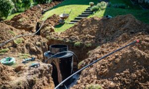
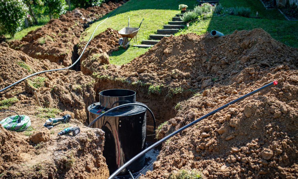
Decide before construction which items the survey crew must measure while the trench is open. After backfill, the only ways to confirm a buried pipe are guessing from notes or digging it up again. Neither option is cheap or reliable.
Common checkpoints include pipe inverts at structures, the connection to the existing main, service stubs and crossings where two utilities need a set separation. Valve and hydrant locations often join that list. The engineer can point out which items the approved plans or city review call for.
Set clear hold points with the contractor. A hold point is a pause in the work until the survey crew records a location. Agree on how much notice the crew needs and who makes the call. This field information can support record drawings later, although record requirements vary by project and municipality.
Frequently Asked Questions
When should a construction survey be scheduled for a utility extension?
Contact the survey team once the engineer has plans close to final and before the contractor mobilizes. That lead time lets the crew set control and compare the design with site conditions. After that, field visits usually follow the construction schedule rather than one fixed date.
What plans should be available before requesting construction survey work?
The survey team needs the current approved construction drawings, including utility plans and profiles. Site plans, grading plans and any city approval conditions help too. Share recorded easement documents and the engineer’s design files when you can, since they let the crew stake from the same data the engineer used.
Can design changes require additional construction survey work?
Yes. A revised alignment, grade, structure location or connection point can make stakes in the field wrong. Send every revision to the survey team right away so the crew can recalculate and restake only what changed.