Property Survey After Storms: Protect Against Disputes
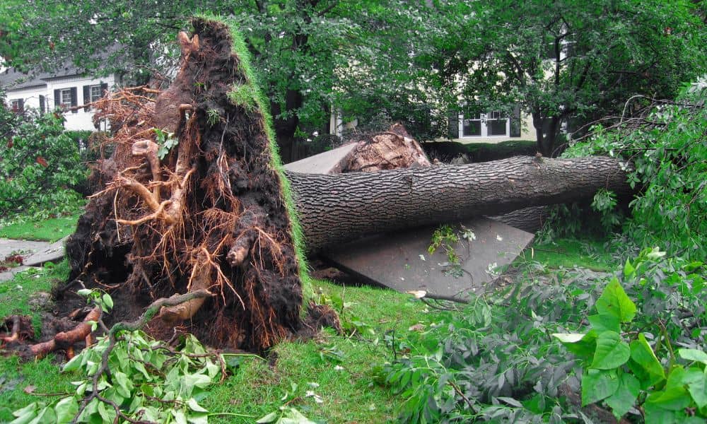
Massachusetts weather can surprise even longtime residents. Just this past week, the National Weather Service confirmed five tornadoes in MetroWest towns like Paxton, Holden, Berlin, and Stow. For many homeowners, the damage went far beyond downed trees and missing shingles. Uprooted roots tore through fences, stone walls shifted, and survey markers disappeared under debris. When […]
Drone Land Surveying vs. iPhone 17 Pro Scans

Boston’s rowhouses are full of charm, but they also bring big headaches when it comes to measurements and planning. Narrow alleys, basement corners, and shared walls make every inch matter. That’s why drone land surveying has become such a useful tool for engineers, architects, and homeowners here. But with the new iPhone 17 Pro getting […]
Flood Elevation Survey Demand Rises After Major Storms
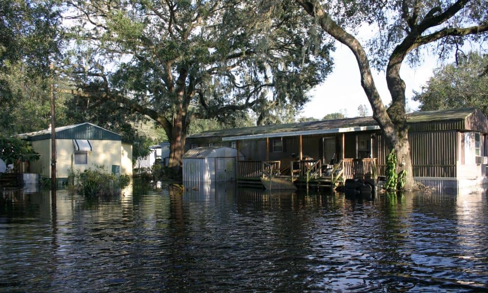
Boston has always been a city shaped by water. From the Charles River to Boston Harbor, the landscape blends old neighborhoods with low-lying land. After the severe storms that swept through Massachusetts in early September—including a tornado in central Massachusetts and heavy rainfall across the city—many homeowners and lenders are asking a new question: Do […]