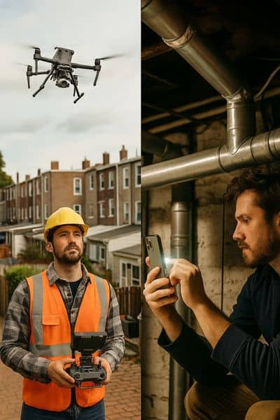
Boston’s rowhouses are full of charm, but they also bring big headaches when it comes to measurements and planning. Narrow alleys, basement corners, and shared walls make every inch matter. That’s why drone land surveying has become such a useful tool for engineers, architects, and homeowners here. But with the new iPhone 17 Pro getting buzz for its upgraded LiDAR scanner, some people are asking: Could a phone replace the need for drones or even professional survey work?
The iPhone 17 Pro Hype
Apple’s latest iPhone isn’t just another shiny gadget. The 17 Pro comes with improved LiDAR sensors and a stronger cooling system that allows longer scanning sessions. Reviewers at Tom’s Guide and Popular Mechanics point out that the device now captures smoother, more accurate depth data than before. For everyday users, that means better 3D models of rooms, furniture, or even small architectural features.
On paper, it sounds impressive. You can walk around your parlor floor, scan a space in minutes, and instantly view a 3D model. For someone planning a renovation, that feels like magic. But the question is: does it hold up in the real world of rowhouses where accuracy and liability matter?
What Drone Land Surveying Brings to the Table
Drones aren’t new, but their role in surveying has grown quickly. In Boston, drone land surveying helps tackle the city’s mix of historic and modern buildings. Experienced drone land surveyors can fly above rooftops, across narrow backyards, and over construction sites to gather data with incredible accuracy.
Unlike a phone scan, drone surveys tie their data to control points on the ground. This means the results aren’t just pretty pictures—they’re measurements you can trust. When an architect needs to know if an alley is exactly ten feet wide, or when a developer wants to confirm roof heights for a dormer addition, these professionals can deliver numbers with confidence.
Another key difference is liability. If you’re dealing with property lines, setbacks, or encroachment disputes, only certified surveys stand up in court or meet city permit requirements. A phone scan might be helpful for a quick visual, but it can’t replace a surveyor’s stamp.
Putting Them to the Test in a Boston Rowhouse

Imagine a three-story rowhouse in the South End. The owner wants to remodel the basement, update the rear addition, and check if the fence is sitting on the property line. Here’s how each tool would perform:
- iPhone 17 Pro: Easy to carry around. In the basement, it can capture the general layout of pipes and ductwork. On the parlor floor, it can create a quick model for an architect to sketch ideas. But once you head outside, problems show up. The phone struggles with bright sunlight, glossy surfaces, and long distances. Measurements may drift, leaving gaps or warped lines.
- Drone land surveying: The drone flies above the roof, down the rear yard, and along the alley. Using GPS and photogrammetry, it captures the property’s envelope in detail. The surveyor then processes the data and checks it against control points. The result is a set of accurate dimensions tied to the legal property lines—something the homeowner can rely on for permits or boundary questions.
The difference is clear: the iPhone provides speed and convenience indoors, while drones deliver professional-grade accuracy outdoors.
Why Accuracy and Liability Matter
In construction and real estate, a few inches can make or break a project. A fence built a foot over the line can lead to lawsuits. A dormer built without accurate height data can trigger permit rejections. That’s where drone land surveying proves its value.
Homeowners sometimes ask, “Isn’t a phone scan good enough for my project?” The honest answer: it depends. If you just want a visual model for early design, the iPhone works fine. But if you’re investing in construction, dealing with property disputes, or applying for permits, you need survey data that holds up legally. A phone scan simply can’t provide that assurance.
The Best of Both Worlds
The truth is, it doesn’t have to be either-or. The smartest approach is often a mix of tools. An architect might use an iPhone 17 Pro to capture a quick interior model and send it to the design team. At the same time, a surveyor might use drones to map the exterior with precision. Together, these datasets create a complete picture of the property, reducing mistakes and speeding up the design process.
For professionals, this hybrid workflow saves time and money. Instead of sending crews back to measure missed corners or recheck rooflines, you get it right the first time. The client benefits from faster pricing, smoother coordination, and fewer delays.
What Homeowners and Builders Should Know
If you’re planning a renovation, addition, or new build, here’s the simple breakdown:
- Use iPhone scans for quick visuals, early design ideas, and interior layouts.
- Rely on drone land surveying for exterior mapping, boundary questions, and anything tied to permits or construction.
- Always work with a licensed surveyor when your project involves property lines, legal disputes, or compliance with city codes.
This way, you get the speed of new consumer tech without risking costly mistakes.
The Bottom Line
Boston’s tight rowhouses aren’t easy to measure, but that’s exactly why accuracy matters. The iPhone 17 Pro is exciting and useful for small-scale documentation. Still, it can’t match the reliability and precision of drone land surveying, especially when property rights or construction deadlines are on the line.
So, can new tech handle the toughest spaces? The answer: it helps, but it doesn’t replace professional surveying. Use the right tool for the right job, and your project will move forward with fewer surprises.


