If you’ve ever worked on a construction site, you know how one small mistake can spiral into chaos. A missing layout stake might seem harmless, but it can delay inspections, misalign a foundation, or even trigger legal issues. That’s why a construction staking survey is more than just a formality—it’s your project’s safety net.
In Boston, where builds happen on narrow city lots and regulations are strict, survey stakes are the quiet heroes that keep projects accurate and compliant. When they get moved, kicked, or ignored, precision disappears—and rework begins.
When Stake Flags Vanish, Costs Climb Fast
Just last week, a viral Reddit post caught the attention of surveyors across the U.S. A frustrated builder wrote, “Fence crew pulled every stake before inspection—we had to restake the entire site.” Hundreds of comments poured in from contractors and surveyors who’d faced the same nightmare.
It’s a story that hits home in Boston. When stakes disappear, the domino effect begins: crews lose layout references, concrete gets poured in the wrong spot, and deadlines slip. Once that happens, the only fix is to resurvey the site and, in many cases, tear out the mistake.
Massachusetts law even takes this seriously. Chapter 266, Section 94 of state law makes removing or damaging survey stakes a punishable offense. Still, the problem happens often—not from malice, but misunderstanding. Too many people on site don’t realize those little wooden stakes are the foundation of the entire project’s accuracy.
What a Construction Staking Survey Actually Does
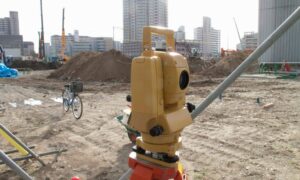
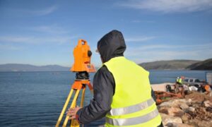
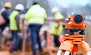
A construction staking survey transforms your approved design plans into precise physical points on the ground. Using total stations, robotic equipment, or GNSS instruments, the surveyor marks exactly where structures, utilities, and grades belong.
In simple terms, it’s how surveyors make sure that what you build matches what engineers designed.
Every stake, hub, and flag carries meaning:
- A corner of the foundation.
- The depth of a trench.
- The slope of a driveway or drainage path.
Without those, a site becomes a guessing game—and in Boston’s compact neighborhoods, there’s no room for guesswork.
Why This Matters More in Boston Right Now
October marks the height of Boston’s fall construction rush. Crews are racing to pour concrete and wrap projects before winter. That’s when mistakes spike. Tight job sites, overlapping trades, and short daylight hours make it easy for stakes to get disturbed.
Boston’s terrain also adds a challenge. Parts of Dorchester, East Boston, and the Seaport sit near flood zones. When elevation stakes shift, flood-zone compliance can slip too. That leads to inaccurate flood elevation certificates, higher insurance rates, or project delays while elevations are rechecked.
In short, a lost stake can cost you more than time—it can hit your bottom line.
Real Consequences of Ignoring Stake Flagging
When layout markers are ignored or misplaced, three things usually follow:
- Rework and Resurveying: The survey team must return, verify control points, and restake the site. That means extra hours and extra cost.
- Failed Inspections: If the foundation doesn’t match approved plans, permits can be delayed or revoked.
- Legal Trouble: Misaligned structures can cross property lines, violating local setbacks or neighboring rights.
A surveyor once put it simply: “One pulled stake can cost more than the entire survey.”
How Flood-Zone Worries Tie In
A separate conversation on Reddit last week showed another frustration—Boston homeowners panicking over new FEMA flood ratings. Many didn’t realize that survey data directly affects those risk scores.
If a construction project skips staking or ignores elevation control, the resulting elevations might not match FEMA’s standards. That means higher flood insurance premiums or failed mortgage approvals.
Accurate staking keeps your elevations tied to official datums—like NAVD88 or Boston City Base, which is 6.46 feet higher. It’s a small technical detail with a big financial impact.
How Surveyors Keep Projects Grounded

Experienced surveyors don’t just mark the site and leave. They plan for protection:
- Placing stakes outside heavy-traffic zones.
- Painting offsets or guard stakes to prevent damage.
- Recording digital control points for quick re-checks.
- Using drones to verify layout after grading or storms.
Drone verification has become especially popular this season. A quick flight can confirm elevations, catch grading errors, and document layout before the next trade moves in. It’s a fast safeguard that prevents expensive surprises later.
Working Together to Prevent Rework
The best results come when surveyors, contractors, and homeowners stay in sync. Before construction begins, everyone should understand what the stakes mean and why they matter. A two-minute conversation at the job site can prevent a two-week delay down the line.
If you’re a developer or property owner, make sure your surveyor is licensed and familiar with elevation benchmarks and permit requirements. Ask for layout verification before major pours, and always double-check elevations if your site lies near a mapped flood zone.
When to Call for a Construction Staking Survey
Don’t wait for problems to appear. Bring in a surveyor:
- Before excavation, to mark building corners and control elevations.
- During construction, to verify forms, grades, and utilities.
- After completion, to prepare as-built records for lenders or city approvals.
Each phase builds on the one before it. Skipping a staking survey can undo weeks of work and hundreds of hours of coordination.
The Bottom Line
Ignoring stake flagging may seem minor, but it’s one of the fastest ways to derail a project. In a city as compact and regulated as Boston, precision isn’t optional—it’s survival.
A professional construction staking survey keeps your layout correct, your elevations accurate, and your inspections on schedule. It turns chaos into control.
So before the next pour or foundation check, look around your site. Are your stakes still standing? If not, call your surveyor—because fixing mistakes after the fact will always cost more than doing it right the first time.


